 |
| ||||||||||||||||||||||||||||||||||
| Post PNR | Post Blog | Advanced Search |
Filters:
Sadly IR who lost all the records is propagating false history.


#Know_Your_History #Old_IR_Maps
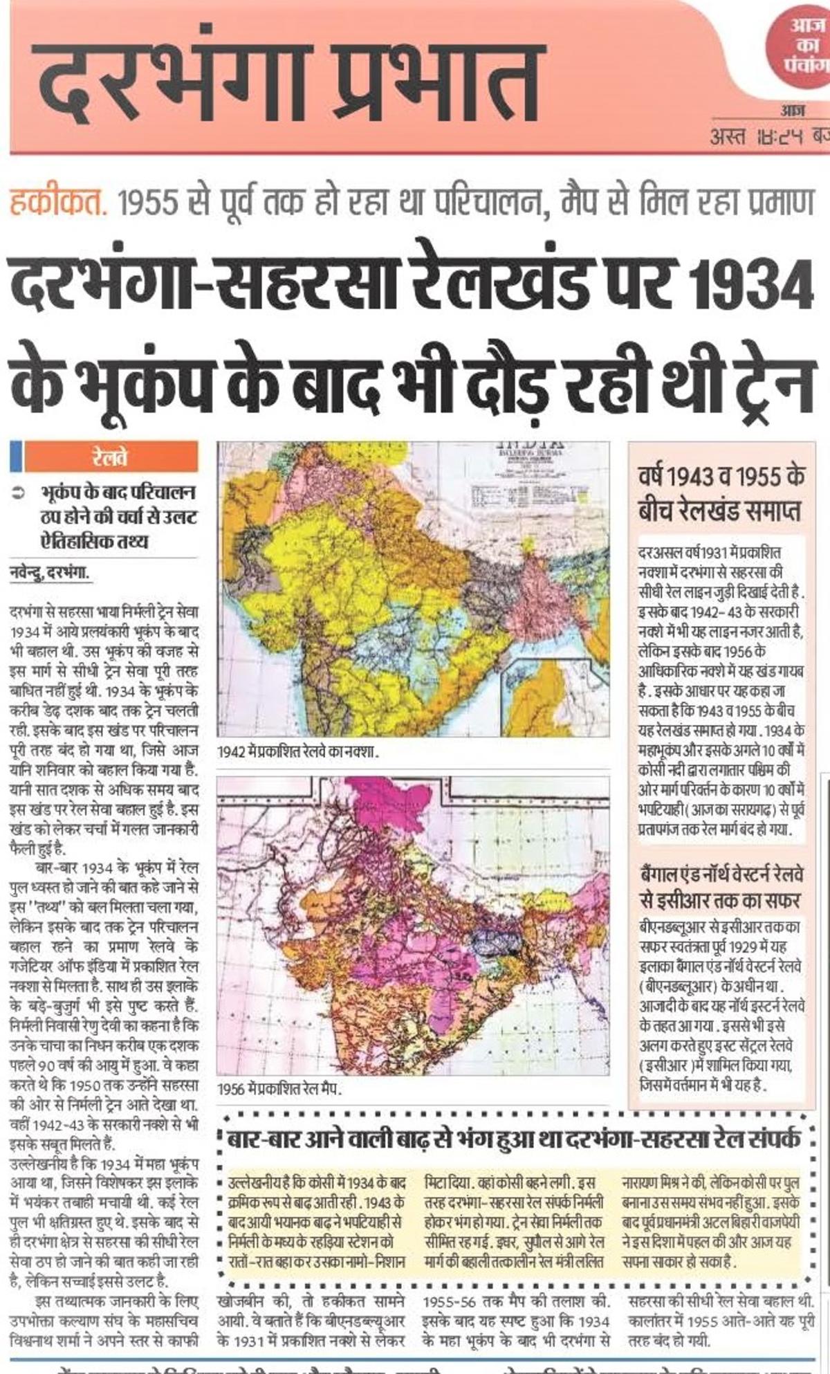
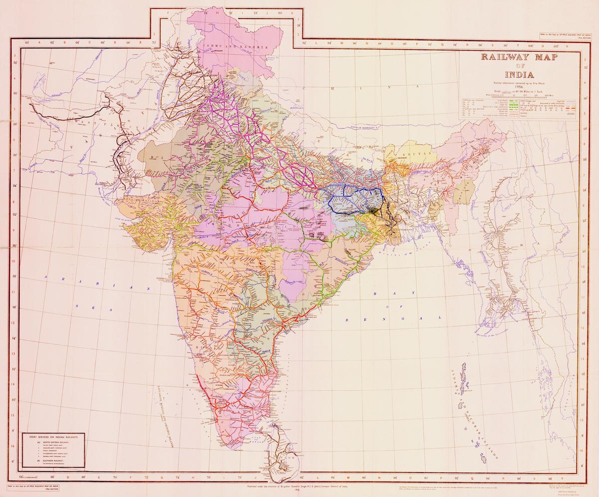
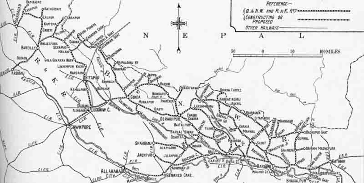
Sharing some very OLD and official Map of Indian Railway System
These high resolution #Map (except B/W) are very authentic and are of 1931/1942-43 and 1956
These Maps also clearly proves that Indian Railways has no proper authentic info about her own history thus often gives wrong info in pulic
Example...
more...
8 Public Posts - Thu May 05, 2022

The bridge between Muktapur-Samastipur was completed long back but due to unfinished track joining work laying unused.
4k video
click here
1 Public Posts - Sun Apr 24, 2022
1 Public Posts - Sun May 15, 2022
Feb 24 2022 (12:38) 17008/Darbhanga - Secunderabad Express (PT) | DBG/Darbhanga Junction (5 PFs)
Vishwanath
Vishwanath 20299 blog posts
Running of Goods train commenced.
passenger trains to start from January.
Travel SAFE
1. RailFanning does NOT MEAN dangerous pics/videos.
2. Doorplating pics/youtube videos are strictly FORBIDDEN in IRI.
3. Take plenty of food pics and other safe pics.
4. Write human interest narratives to make the pics interesting.
5. Enjoy blogging and travelling SAFELY.
REMEMBER: YOUR LIFE is the most precious thing, NOT RailFanning.
Scroll to Top